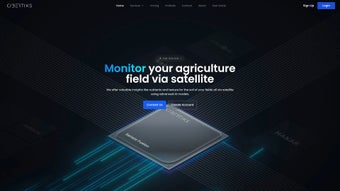

Download Cybertiks – AI‑Powered Satellite Analytics for Agriculture
Overview
Cybertiks is a cutting‑edge web application that brings together advanced artificial intelligence and high‑resolution satellite imagery to deliver precise, data‑driven insights for modern agriculture. Designed specifically for farmers, agronomists, and ag‑tech businesses, the platform translates raw remote‑sensing data into actionable recommendations on soil health, nutrient distribution, water availability, and even potential crop stressors. By processing terabytes of satellite observations through rigorously tested AI models, Cybertiks offers a level of accuracy that rivals on‑the‑ground lab testing, while remaining accessible from any browser‑enabled device.
The service is subscription‑based, providing tiered plans that cater to smallholder farms, large commercial operations, and consultancy firms. Each plan includes a customizable dashboard, automated report generation, and the ability to ingest data from third‑party sensors such as IoT weather stations or soil moisture probes. Although the platform does not support real‑time field monitoring, its strength lies in the depth of historical and near‑real‑time analysis, enabling users to plan planting cycles, optimize fertilizer application, and participate in carbon farming initiatives with confidence.
In addition to its core analytics engine, Cybertiks offers bespoke software development services, allowing enterprises to extend the platform with proprietary data streams or integrate the output directly into existing farm management systems. The result is a comprehensive, secure, and scalable solution that empowers sustainable farming practices across diverse climatic zones worldwide. By centralising satellite‑derived intelligence in a single, user‑friendly portal, Cybertiks reduces the need for multiple specialist tools, cuts operational costs, and accelerates decision‑making cycles for agribusinesses of any size.
Key Features, Compatibility, and Installation
Feature List
- Satellite‑Based Soil Mapping: High‑resolution multispectral imagery combined with AI to generate detailed soil texture, organic matter, and pH maps.
- Nutrient & Fertility Insights: Predictive models estimate nitrogen, phosphorus, and potassium levels, helping users fine‑tune fertilizer regimes.
- Water Availability Monitoring: Evapotranspiration and moisture indices highlight irrigation needs and drought risk zones.
- Pollution & Contamination Detection: Algorithms flag potential heavy‑metal hotspots or pesticide drift based on spectral signatures.
- Human Activity & Land‑Use Change Tracking: Change‑detection tools identify recent land conversion, illegal logging, or unauthorized field expansion.
- Carbon Farming Metrics: Quantifies soil carbon sequestration potential, supporting verification for carbon credit programs.
- Custom Report Builder: Drag‑and‑drop interface to create PDF or interactive HTML reports for stakeholders.
- Sensor Fusion Capability: Seamlessly integrates data from IoT devices, weather stations, and UAVs to enrich satellite insights.
- Role‑Based Access Control: Secure user management ensures that only authorized personnel can view or edit sensitive data.
- API Access & Webhooks: Enables developers to pull analytics into third‑party farm management platforms or trigger automated alerts.
Operating System Compatibility
Because Cybertiks is delivered as a browser‑based SaaS solution, it runs on all major operating systems, including Windows 10/11, macOS 12+, Linux distributions, as well as mobile platforms such as Android 8+ and iOS 13+. The platform is optimized for modern browsers (Chrome, Firefox, Edge, Safari) and employs responsive design to ensure a smooth experience on tablets and smartphones.
Installation & Usage Instructions
Although no local installation is required, a smooth onboarding process is essential for maximizing the platform’s value. Follow these three steps to get started:
- Account Creation & Subscription Selection: Visit the official Cybertiks website, click “Sign Up,” and choose a plan that matches your acreage and data‑integration needs. Payment is processed securely via credit card or bank transfer, and a 14‑day free trial is offered for new users. After registration, you’ll receive a verification email and a welcome guide that outlines the dashboard’s main components.
- Field Definition & Data Source Configuration: Use the built‑in map editor to draw field boundaries or import shapefiles (KML, GeoJSON, or ESRI Shapefile). Next, connect external sensors by providing API keys or uploading CSV files. The platform automatically synchronizes with selected satellite providers, and you can schedule data refresh intervals based on your subscription tier.
- Dashboard Personalization & Report Scheduling: Drag widgets onto your home screen to display the metrics most relevant to your operation—soil health, water stress, carbon stock, etc. Set up automated weekly or monthly report delivery via email, or download reports on demand in PDF, Excel, or interactive HTML format. Advanced users can create custom alerts that trigger when a specific threshold (e.g., nitrogen deficiency) is crossed.
System Requirements & Performance Tips: A stable internet connection with at least 5 Mbps download speed is recommended for loading high‑resolution satellite layers. For heavy users who generate large custom reports, a minimum of 8 GB RAM and a dual‑core processor will improve rendering times. The application automatically caches recently accessed maps locally, reducing bandwidth usage on subsequent sessions.
Support & Training: New users gain access to an interactive tutorial, a searchable knowledge base, and live chat support during business hours. Enterprise customers receive a dedicated account manager who provides onboarding webinars, API integration assistance, and quarterly performance reviews to ensure that the platform continues to meet evolving agronomic goals.
Pros, Cons & Frequently Asked Questions
Pros
- Highly accurate AI‑driven soil and nutrient analysis backed by up‑to‑date satellite data.
- Web‑based interface eliminates the need for complex local installations.
- Extensive sensor‑fusion capability allows seamless integration of IoT and UAV data.
- Role‑based access and ISO‑27001 compliance ensure data security and privacy.
- Customizable reporting and API access support a wide range of agribusiness workflows.
- Transparent accuracy scores for each analytic layer give users confidence in decision‑making.
Cons
- No real‑time in‑field monitoring; data refresh is limited to satellite revisit cycles (typically 5‑10 days).
- Subscription cost may be prohibitive for very smallholder farms without group purchasing.
- Initial learning curve for users unfamiliar with remote‑sensing terminology.
- Dependence on internet connectivity can be challenging in remote rural areas.
Frequently Asked Questions
How often is the satellite data updated?
Cybertiks leverages multiple satellite constellations; Sentinel‑2 provides new imagery every 5 days, while commercial providers like PlanetScope can deliver updates as frequently as daily, depending on your subscription tier.
Can I import my own field boundaries?
Yes. The platform accepts shapefiles, KML, and GeoJSON formats. You can also draw polygons directly on the interactive map editor.
Is there a mobile app for on‑the‑go access?
While Cybertiks is a web application, its responsive design works fully on Android and iOS browsers. A native mobile app is under development for future releases.
What kind of support is available for API integration?
Enterprise customers receive a dedicated technical account manager, detailed API documentation, and sandbox environments for testing. Standard plans have access to community forums and email support.
Does Cybertiks help with carbon credit verification?
Yes. The platform calculates soil carbon sequestration estimates and generates standardized reports that align with major carbon registry requirements.
Can I integrate Cybertiks data with existing farm management software?
Absolutely. Through RESTful APIs and webhooks, you can push analytics directly into popular farm management platforms such as Climate FieldView, Trimble Ag Software, or custom ERP systems.
Conclusion & Call to Action
In a world where data‑driven agriculture is no longer a luxury but a necessity, Cybertiks stands out as a powerful, secure, and user‑friendly solution for anyone serious about optimizing yields, conserving resources, and participating in emerging carbon markets. Its blend of satellite‑derived insights, AI‑enhanced analytics, and flexible integration points makes it a compelling choice for farms of all scales—from boutique organic growers to multinational agribusinesses. The platform’s transparent accuracy scores, role‑based security, and extensive support ecosystem further reinforce its position as a trusted partner in sustainable farming.
If you are ready to transform your field management strategy with precise, actionable intelligence, sign up for a free 14‑day trial today. Experience firsthand how AI and satellite data can turn uncertainty into confidence, and join the growing community of growers who are shaping the future of sustainable agriculture. Download Cybertiks now, integrate it with your existing tools, and start making data‑backed decisions that boost profitability while protecting the planet.
Pros: Accurate AI models, extensive satellite coverage, excellent integration options, transparent confidence scores.
Cons: No real‑time field sensors, subscription price for small farms, requires reliable internet.



.png)